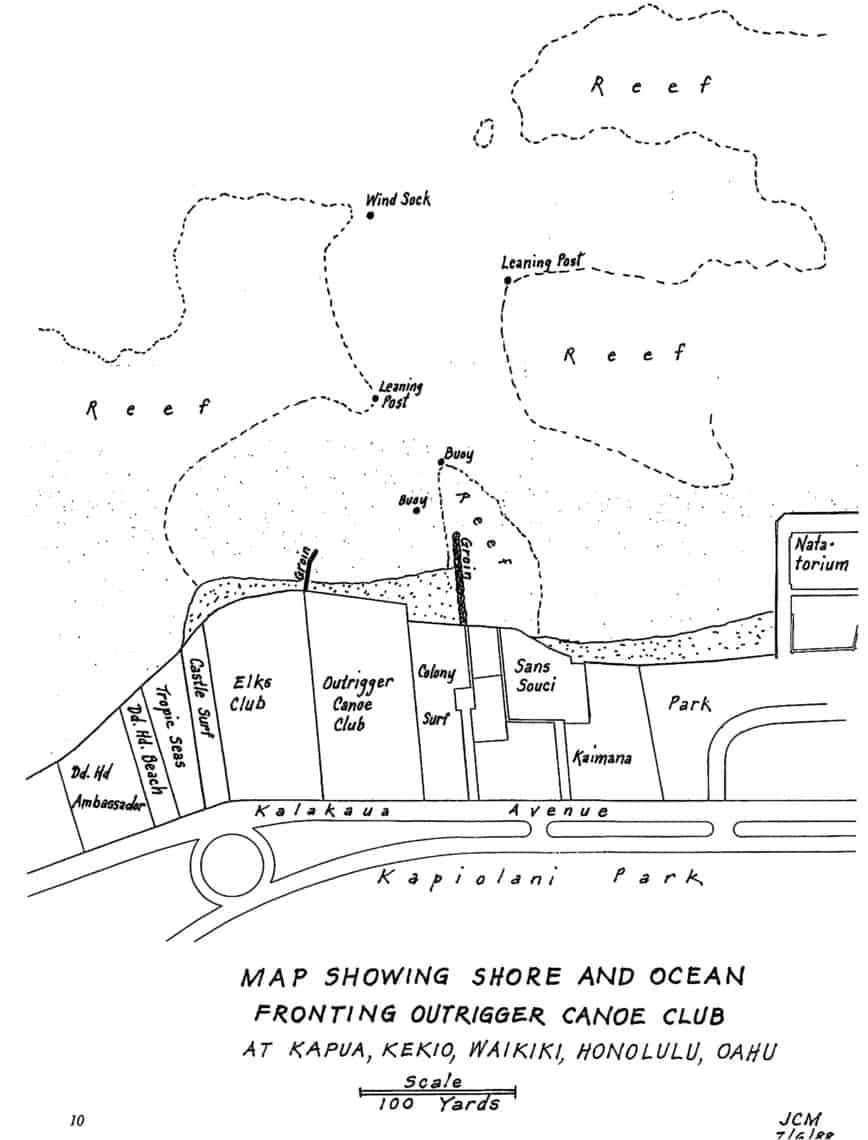
This map was created by Winged “O” and former OCC President John Cline Mann, a surveyor by profession, of the swimming area in front of the Club. Below are suggestions from members for swimming routes from Castle Surf to the Natatorium. The map delineates the reefs you want to avoid when you’re swimming and the Leaning Posts and Wind Sock you might want to use as milestones. The map is scaled so that 1 1/2 inches equals 100 yards.
Diane Stowell
“Waikiki Bay is one of the most beautiful areas in which to swim and very convenient to get to. Out beyond the Wind Sock, turn right and swim along the reef area. It’s beautiful with so many colored fish and sometimes rays and turtles. The boats usually do not come too close, but you should always be on the lookout. Bathing caps in bright colors help you be visible. It is hard to see swimmers as they are so low in the water.”
Bonnie Eyre
“Swim around the boats in front of the Club. Swim from the Club beach out to the Wind Sock and back. Swim from the front of Sans Souci out to the Wind Sock and back.” She reminds members and guests that they swim at their own risk. The Club does not have lifeguards on duty, only beach attendants to assist with equipment. “You should be an experienced swimmer because there are currents in this area. It is always best to swim with someone.”
Jim Anderson
“Swim around the boat anchorage and loop around the boats. The distance from the end of the Colony Surf groin to the Wind Sock is about 1/8 mile, or a round trip of 1/4 mile. Swim around the Colony Surf Groin down to the Natatorium and back. For longer swims, go out to the Wind Sock, come in hugging the reef to the left, to the Natatorium wall, then along the beach, out to the Wind Sock and back to the Club Beach. There are lots of opportunities to view our sea life neighbors on the route around the Hobies and the Natatorium route.
Pam Zak
“Avoid reef areas during low tides. Also be alert to rocks in front of the Colony Surf groin that are dangerous during low tides. If you try to cut in over the rocks during low tide, you will get cuts. There are also lots of wana in that area.”
Current Patterns Off the Outrigger
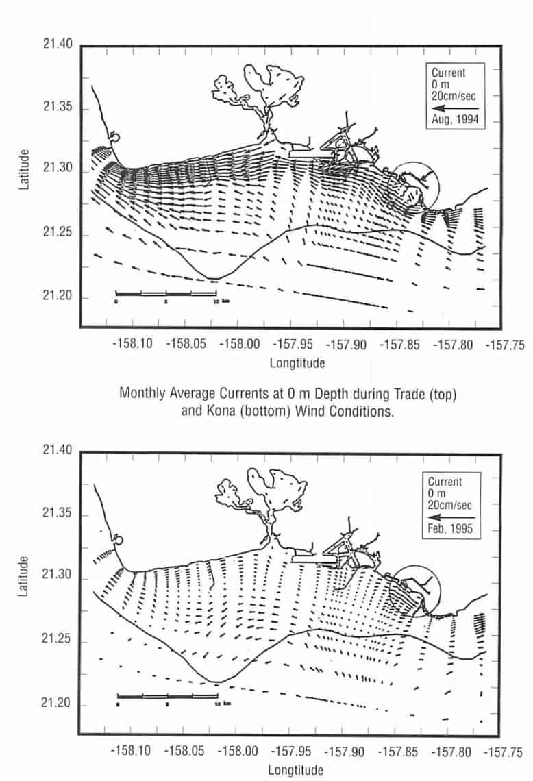 By Arnold Lum
One of the interesting aspects of the Mamala Bay Study, commissioned by the City & County of Honolulu as a result of the Sand Island sewage treatment plant lawsuit, is an analysis of the current patterns near the Club. As you can see, the attached figures (reprinted from the draft study report, which was published in 1995) indicate that during both tradewind and Kona weather, the current off Waikiki trends towards Diamond Head. However, east of the Club, toward Tonggs, the current trends towards Ewa when the trades are blowing, and towards Diamond Head during Kona weather conditions.
We’ve probably all noticed it’s harder to paddle from the cliffs off Diamond Head back to the Club when the wind is out of the south, and that even when the trades are light during the Waikiki Roughwater Swim, the current still seems to set against us as we swim towards the Hilton. The results of the Mamala Bay study appear to confirm what many of us think is happening in the ocean, based upon experience.